Read the statement by Michael Teeuw here.
MMM-GoogleMapsTraffic
-
did what you said and did the config check and this is what i got
Line 134 col 5 Unexpected ‘]’.
Line 134 col 5 Expected an identifier and instead saw ‘]’.
Line 134 col 6 Missing semicolon.
Line 134 col 5 Unrecoverable syntax error. (95% scanned).
pi@raspberrypi:~/MagicMirror $ -
it says line 134 but the only thing on line 134 is a ]
here is my code leading up to 134
		{
    module: "MMM-EARTH",
    position: "bottom_center",
    config: {
        mode: "Natural",
        rotateInterval: 15000,
        MaxWidth: "50%",
        MaxHeight: "50%",
    }
},


	]

};
That is line 116 to 136 the end of my config
-
This is your current config entry
var config = {
modules: [
    {
        module: 'MMM-GoogleMapsTraffic',
        position: 'bottom_left',
        config: {
            key: 'YOUR_KEY',
            lat: 37.8262306,
            lng: -122.2920096,
            height: '300px',
            width: '300px'
            styledMapType: "transparent",
            disableDefaultUI: true,
            backgroundColor: 'hsla(0, 0%, 0%, 0)',
            markers: [
                {
                    lat: 37.8262316,
                    lng: -122.2920196,
                    fillColor: '#9966ff'
                },
            ],
        },
    }
]
Make it look like this or copy and paste
    {
        module: 'MMM-GoogleMapsTraffic',
        position: 'bottom_left',
        config: {
            key: 'YOUR_KEY',
            lat: 37.8262306,
            lng: -122.2920096,
            height: '300px',
            width: '300px'
            styledMapType: "transparent",
            disableDefaultUI: true,
            backgroundColor: 'hsla(0, 0%, 0%, 0)',
            markers: [
                {
                    lat: 37.8262316,
                    lng: -122.2920196,
                    fillColor: '#9966ff'
                },
            ],
        },
Props to @evroom
-
@mykle1 said in MMM-GoogleMapsTraffic:
{
    module: 'MMM-GoogleMapsTraffic',
    position: 'bottom_left',
    config: {
        key: 'YOUR_KEY',
        lat: 37.8262306,
        lng: -122.2920096,
        height: '300px',
        width: '300px'
        styledMapType: "transparent",
        disableDefaultUI: true,
        backgroundColor: 'hsla(0, 0%, 0%, 0)',
        markers: [
            {
                lat: 37.8262316,
                lng: -122.2920196,
                fillColor: '#9966ff'
            },
        ],
    },
still getting a error
-
Sorry about that. I just checked it. Try this please. There was a comma missing after
width: '300px',and no comma after the closing } Not your fault. The example in the readme is incorrect{ module: 'MMM-GoogleMapsTraffic', position: 'bottom_left', config: { key: 'YOUR_KEY', lat: 37.8262306, lng: -122.2920096, height: '300px', width: '300px', styledMapType: "transparent", disableDefaultUI: true, backgroundColor: 'hsla(0, 0%, 0%, 0)', markers: [ { lat: 37.8262316, lng: -122.2920196, fillColor: '#9966ff' }, ], } }, -
this worked thank you!!
-
You’re welcome, mate. :thumbsup:
-
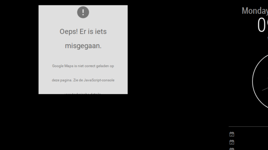
it all seems to be working but googlemaps can not be loaded, i used a new key though
any ideas?

-
@rvanuden anyone?
-
@rvanuden I have the same problem. Did you find a solution?
