• Recent
  • Tags
  • Unsolved
  • Solved
  • MagicMirror² Repository
  • Documentation
  • 3rd-Party-Modules
  • Donate
  • Discord
  • Register
  • Login
MagicMirror Forum
  • Recent
  • Tags
  • Unsolved
  • Solved
  • MagicMirror² Repository
  • Documentation
  • 3rd-Party-Modules
  • Donate
  • Discord
  • Register
  • Login
A New Chapter for MagicMirror: The Community Takes the Lead
Read the statement by Michael Teeuw here.

ISS tracker

Scheduled Pinned Locked Moved Requests
33 Posts 5 Posters 15.7k Views 5 Watching
Loading More Posts
  • Oldest to Newest
  • Newest to Oldest
  • Most Votes
Reply
  • Reply as topic
Log in to reply
This topic has been deleted. Only users with topic management privileges can see it.
  • M Offline
    Manu85 @bhepler
    last edited by Feb 14, 2024, 1:11 PM

    @bhepler @karsten13
    hello, this sharing of experience is wonderful, well done to you for pooling complementary experiences, I admire that two “different” projects can be complementary, I would really like to be able to have your knowledge to share it with others other people thank you

    1 Reply Last reply Reply Quote 0
    • B Offline
      BerkSmash1984
      last edited by BerkSmash1984 Feb 14, 2024, 2:44 PM Feb 14, 2024, 2:42 PM

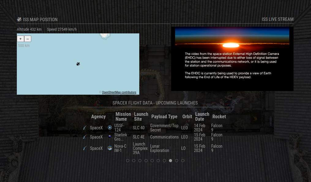
      I have this implemented alongside MMM-ISS-Live and MMM-SpaceX and it looks great!
      a92d2a17-6f5c-4a93-b376-131325ae8389-image.png

      @karsten13 Any chance we can get a config option to use imperial units in the next update for the altitude and speed calculations? Also, an option to disable those calculations altogether?

      K 1 Reply Last reply Feb 14, 2024, 7:25 PM Reply Quote 1
      • K Offline
        karsten13 @bhepler
        last edited by Feb 14, 2024, 7:23 PM

        @bhepler said in ISS tracker:

        @karsten13 - I don’t know which map framework you’re running, but I’ve been using Leaflet and it gives me a lot of flexibility in maps. Several free tile sources and many more that just require an API key. You can see a simple example at my MMM-Birdnet module. Specifically, check out the map options.

        thanks!

        I’m using ol (openlayers), with your help I found already the free cards of cartodb, they should work with ol too.

        1 Reply Last reply Reply Quote 1
        • K Offline
          karsten13 @BerkSmash1984
          last edited by Feb 14, 2024, 7:25 PM

          @BerkSmash1984 said in ISS tracker:

          @karsten13 Any chance we can get a config option to use imperial units in the next update for the altitude and speed calculations? Also, an option to disable those calculations altogether?

          this is a small thing, will put it on my todo list, as I’m total unfamiliar with imperial units: Which are the ones you want to see, ft and mph?

          K B 2 Replies Last reply Feb 14, 2024, 8:15 PM Reply Quote 0
          • K Offline
            karsten13 @karsten13
            last edited by Feb 14, 2024, 8:15 PM

            @karsten13 said in ISS tracker:

            Which are the ones you want to see, ft and mph?

            used now mi and mph …

            There is a new version with the above option and a new default map.

            M 1 Reply Last reply Feb 14, 2024, 9:34 PM Reply Quote 0
            • M Offline
              Manu85 @karsten13
              last edited by Feb 14, 2024, 9:34 PM

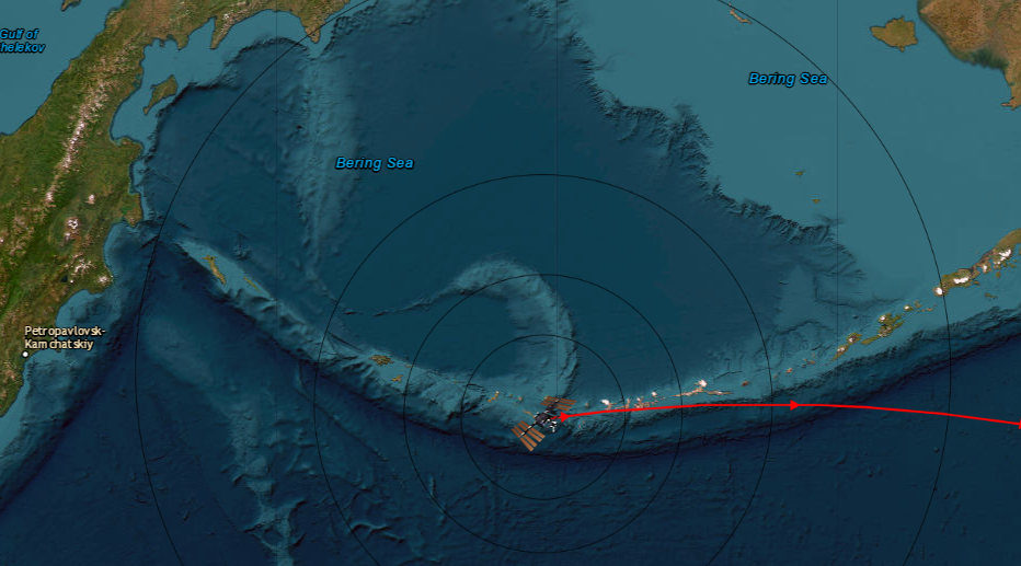
              @karsten13 Bravo and thank you for your responsiveness, this card is more beautiful, the best would be to have a more colorful card, but you are at the top again, congratulations for your work
              ddee7ce4-1104-49d9-a881-9f88e0cd16c8-image.png

              K 1 Reply Last reply Feb 14, 2024, 9:47 PM Reply Quote 1
              • K Offline
                karsten13 @Manu85
                last edited by Feb 14, 2024, 9:47 PM

                @Manu85

                AFAIS they combine several layers, they are visible in the source code of the page.

                For the main layer you can try

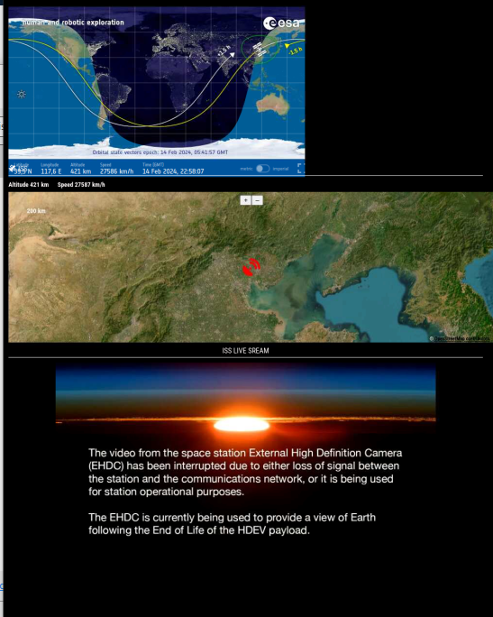
                        mapUrl: "https://server.arcgisonline.com/ArcGIS/rest/services/World_Imagery/MapServer/tile/{z}/{y}/{x}",
                
                M M 2 Replies Last reply Feb 14, 2024, 10:08 PM Reply Quote 0
                • M Offline
                  manu85340 @karsten13
                  last edited by Feb 14, 2024, 10:08 PM

                  @karsten13 thank you for your answer, I will try

                  1 Reply Last reply Reply Quote 0
                  • M Offline
                    Manu85 @karsten13
                    last edited by Feb 14, 2024, 11:00 PM

                    @karsten13 great, it works however there are no longer the names of the cities, do you think it would be possible to have a mix of the two? you are at the top, well done
                    4d73290b-2ec5-4161-a464-61b03105f6c1-image.png

                    K 1 Reply Last reply Feb 15, 2024, 9:15 PM Reply Quote 0
                    • B Offline
                      BerkSmash1984 @karsten13
                      last edited by BerkSmash1984 Feb 15, 2024, 2:59 PM Feb 15, 2024, 1:15 PM

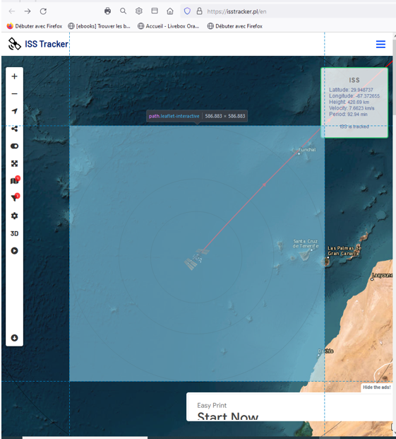
                      @karsten13 Awesome! I updated the module and my config, and see the imperial units. Thanks!
                      1 Reply Last reply Reply Quote 0
                      • 1
                      • 2
                      • 3
                      • 4
                      • 2 / 4
                      2 / 4
                      • First post
                        16/33
                        Last post
                      Enjoying MagicMirror? Please consider a donation!
                      MagicMirror created by Michael Teeuw.
                      Forum managed by Sam, technical setup by Karsten.
                      This forum is using NodeBB as its core | Contributors
                      Contact | Privacy Policy