Read the statement by Michael Teeuw here.
-
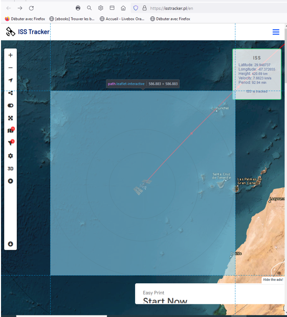
Hello everyone, I need your help because I do not have the technical capacity to do this, do you think it would be possible to build a module to complete MMM-ISS-Live which would allow you to follow the route of the ISS with the names of the countries and cities, on the internet I found this site which does exactly what I would like, by zooming in on the map it gives the names of the cities, I made a screenshot, thank you for your help because I am unable to do this, the site is as follows:
https://isstracker.pl/en
the screenshot below
-
S sdetweil moved this topic from Forum on
-
Good evening everyone I continue to look for a solution for the ISS tracker and I found this github, which was produced by students (much more talented than me…) would anyone be able to make it compatible with MM?
thank you in advance for your helphttps://github.com/ishaanbhimwal/ISS-Tracker?tab=readme-ov-file
-
-
@karsten13 incredible, can’t wait for it to be operational, thank you for the work
-
-
@karsten13 Thank you for your work, I just installed it and it works very well, thank you again, I have a few questions to ask you, I want to change the default map which is a little simple, I tried, as you say recommend with mapbox and when I go to the site you have to register and obviously it’s paying, you have to add a bank card, do you think there is the possibility of adding a more “fun” card “? I also saw that you had development projects, BRAVO for what you did
-
I know about the map problem but I can’t solve it, therefore the module is very flexibel, you can bring your own map and also your own svg for the icon (and change icon color in the svg).
In the past there were many free tile server (for maps) but they are all gone. Mapbox had free maps at the time when I signed in but they are counting access and this is limited - I never reached such a limit but I will not publish my tokens otherwise my limit is gone quickly …
-
thank you for your answer, I will try to find a more suitable card, but this one is already very good, thank you and I understand that if you put your card code on the internet your account will “explode” 😂 in your message you are talking about the iss icon, it seems to me, and that we can change it, is that correct? I am not familiar with the possibilities of the modules, could you tell me what to do please? thank you for your help
-
I updated the Readme
-
@karsten13 great, I’ll see about that soon, thanks
-
@karsten13 - I don’t know which map framework you’re running, but I’ve been using Leaflet and it gives me a lot of flexibility in maps. Several free tile sources and many more that just require an API key. You can see a simple example at my MMM-Birdnet module. Specifically, check out the map options.
-
@bhepler @karsten13
hello, this sharing of experience is wonderful, well done to you for pooling complementary experiences, I admire that two “different” projects can be complementary, I would really like to be able to have your knowledge to share it with others other people thank you -
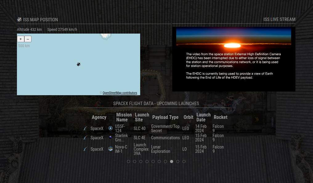
I have this implemented alongside MMM-ISS-Live and MMM-SpaceX and it looks great!
@karsten13 Any chance we can get a config option to use imperial units in the next update for the altitude and speed calculations? Also, an option to disable those calculations altogether?
-
@bhepler said in ISS tracker:
@karsten13 - I don’t know which map framework you’re running, but I’ve been using Leaflet and it gives me a lot of flexibility in maps. Several free tile sources and many more that just require an API key. You can see a simple example at my MMM-Birdnet module. Specifically, check out the map options.
thanks!
I’m using ol (openlayers), with your help I found already the free cards of cartodb, they should work with ol too.
-
@BerkSmash1984 said in ISS tracker:
@karsten13 Any chance we can get a config option to use imperial units in the next update for the altitude and speed calculations? Also, an option to disable those calculations altogether?
this is a small thing, will put it on my todo list, as I’m total unfamiliar with imperial units: Which are the ones you want to see, ft and mph?
-
@karsten13 said in ISS tracker:
Which are the ones you want to see, ft and mph?
used now mi and mph …
There is a new version with the above option and a new default map.
-
@karsten13 Bravo and thank you for your responsiveness, this card is more beautiful, the best would be to have a more colorful card, but you are at the top again, congratulations for your work
-
AFAIS they combine several layers, they are visible in the source code of the page.
For the main layer you can try
mapUrl: "https://server.arcgisonline.com/ArcGIS/rest/services/World_Imagery/MapServer/tile/{z}/{y}/{x}", -
@karsten13 thank you for your answer, I will try
-
@karsten13 great, it works however there are no longer the names of the cities, do you think it would be possible to have a mix of the two? you are at the top, well done

Hello! It looks like you're interested in this conversation, but you don't have an account yet.
Getting fed up of having to scroll through the same posts each visit? When you register for an account, you'll always come back to exactly where you were before, and choose to be notified of new replies (either via email, or push notification). You'll also be able to save bookmarks and upvote posts to show your appreciation to other community members.
With your input, this post could be even better 💗
Register Login